Getting Started
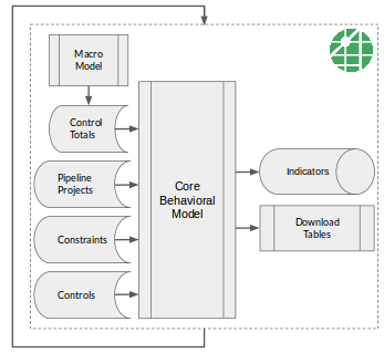
As discussed in the introduction, UrbanCanvas Modeler comes with the tools needed for crafting a small-area socioeconomic forecast using the UrbanSim land use model. Here we give a high-level tour of a typical sequence of modeling steps that can be taken with the platform, with links to more detailed documentation. The core behavioral simulation in UrbanSim is just one piece of putting together an operational forecast. For example, the core behavioral component should be supplemented with local planning knowledge about the real estate development pipeline, land use regulations, and special districts. The workflow descriptions below outline the sequential process that a regional planning agency might take in generating a forecast:
1. Incorporate External Macro Forecast
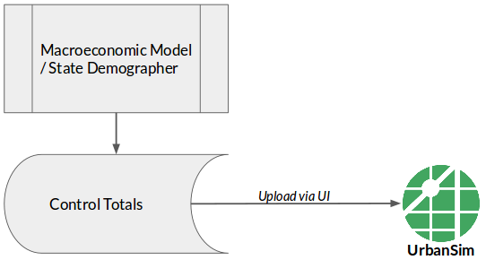
A macro-level forecast is often the starting point for sub-regional allocation. Upload your macro forecast to the platform as an UrbanSim control totals table, associate the control totals with a scenario, and the simulation will then match these control totals at every point in the forecast period. For further details about this step, see documentation on uploaded file formats (for blocks, zones, and parcels) and use of the uploader (for blocks, zones, and parcels).
2. Incorporate Development Pipeline Information
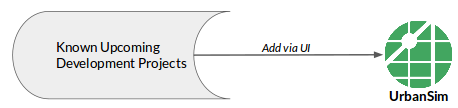
Input and track known upcoming real estate development projects using the platform’s development project editor. These projects then get inserted into the simulation and reflected in forecast results. Development pipeline data for your region is an important element of a small-area forecast. See the documentation on developments (for blocks, zones, and parcels)
3. Incorporate Development Constraints
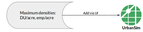
Zoning, development regulations, and natural constraints have implications for the amount of real estate development that can occur. Input development constraint information (i.e. maximum allowable densities), and the simulation then respects these upper bounds and will not build beyond what is prescribed. See the documentation on constraints (for blocks, zones, and parcels).
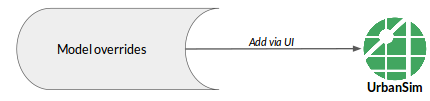
4. Incorporate Model Adjustments
Use the UrbanSim adjustments editor to control small-area simulation outcomes as needed. Adjustments override simulation results in user-defined locations. This can be useful for areas such as military bases and universities, where non-market processes dictate what will occur. Model adjustments can also be used to incorporate feedback from local experts on neighborhood outcomes. Adjustment records can then be tracked in a transparent way over time. See the documentation on adjustments (for blocks, zones, and parcels).
5. Evaluate Simulation Results
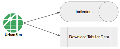
Simulate one or multiple scenarios, and manage simulation runs. View indicators for completed simulation runs, and download results for external analysis or to feed into the regional travel model. See the documentation on simulation runs and indicators on the map or in charts on a dashboard.
6. Establish a Baseline Scenario
After going through steps one through five above for the first time, assess the reasonableness of results, and then make improvements by repeating one or multiple earlier steps. Iterate through the process of incorporating supplemental data into the forecast until the results are reasonable, and then call this the baseline scenario. For scenario composition settings, see the documentation section on scenarios (for blocks, zones, and parcels).
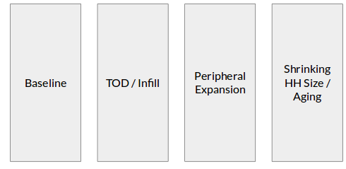
7. Develop Alternative Scenarios
Pivot off of the baseline scenario by creating scenario-specific inputs and composing additional scenarios to utilize those inputs. Create new developments, constraints, and adjustments as needed, and tag them with a scenario-specific label (e.g. “TOD Upzone”). Use the tags feature of the platform to organize model inputs by concept, and then associate concepts with particular scenarios. If a scenario involves different macro-economic assumptions, additional control totals tables can be created, uploaded, and associated with an alternative scenario. See the documentation on scenarios (for blocks, zones, and parcels) and tags.
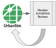
8. Conduct Outreach and Gather Feedback
Present draft forecast results to member jurisdictions and hold public workshops to gather input. Quickly track and organize feedback using the built-in commenting tool. Incorporate any useful feedback as additional developments, constraints, and adjustments. Scenarios can then be modified or added.