Base Data Viewer
The base data viewer provides an interface to examine the information contained in base data collections that have been composed in the base data collection tool. Only collections that have passed the collection internal consistency validation with a Valid or Warning status are available for viewing. The base data geometry for the collection (e.g. parcels) and all the components of a collection can be visualized and queried on the map and in the table interface. The viewer provides a valuable tool to quickly examine or diagnose data errors in your base data prior to use in a simulation and in interpreting simulation results.
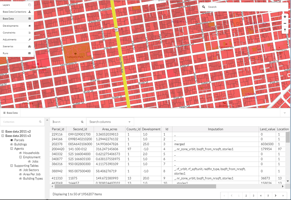
Querying data
To examine the information inside of a collection, first select a collection to view from the left hand side validated collection list and expand a collection’s contents. Click on a table to view from the expanded list and if looking at data that has geometry the map will be populated with the geometry for that table (e.g. parcels or building footprints) and are queryable by clicking on a polygon on the map.
You can search for specific text and values in the collection by typing the words or numbers into the search box and then selecting the columns to query. Multiple columns can be selected for a query. Then hit enter on your keyboard and records that match your search criteria will be displayed in the table. To reset your table view to view all records, remove the text in the search box and hit enter.