Constraints
Zoning, development regulations, and natural constraints have implications for the amount of real estate development that can occur. UrbanCanvas block-model simulations are unconstrained out of the box. However, the platform gives the user the ability to edit constraints to more accurately reflect local general plan or detailed zoning development regulations.
Constraints are changes to residential unit or employment capacity on a block or set of blocks in a given simulation year. Once constraints are in place in a simulation, they persist until the end of the simulation or until overridden by another constraint. Constraints are used to edit base year capacities in a scenario-specific way and to insert capacity changes into simulations beyond the base year.
More information on constraints and capacities in base year data can be found here
Example of a constraint
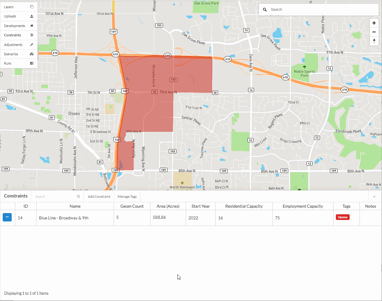
In scenarios that include changes to the transportation network used by the travel demand model, it often makes sense to update capacities on blocks surrounding those facilities. For example, the addition of a new freeway interchange would likely necessitate upzoning for additional employment capacity nearby. This can be added to a scenario and simulation in the same year that the travel demand model network changes using a constraint that updates employment capacity.
Creating a new constraint
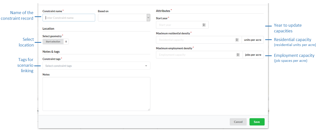
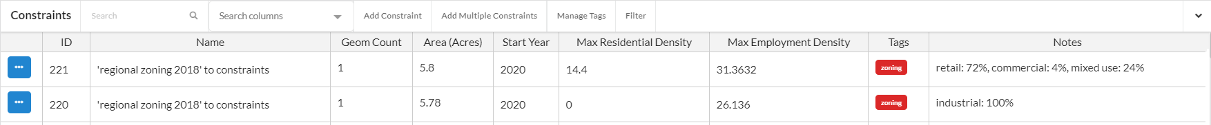
Name (Required)
The name of the constraint should be distinct.
Based on
New constraint records can be based on existing records to quickly create records for different tags and scenarios.
Note
The records available in the Based On dropdown menu currently only shows the names of records that are visible to you in the first page of your table of records. If you do not see a record in the list that you would like to use for Based On, use the table search or filter functions to first create a view of records in the table for which you want to have available in the Based On dropdown menu. This is designed to limit the number of records that appear in the dropdown menu when there are voluminous numbers of records in your table.
Tags (Required)
Tags are applied to constraints so they can be linked with scenarios.
Start Year (Required)
Constraint records update capacities in simulations from the given Start year to the end of the simulation or until overridden by another constraint.
Attributes (Required)
A record can set both residential unit capacity (Max residential density in units per acre) and employment capacity (Max employment density in jobs per acre).
Optional fields
Notes can include source data or any other pertinent information for context.
Click here for more information on selecting Census blocks.
Bulk upload of regional zoning as constraints
Regional zoning data can be uploaded using the zoning uploader tool with files following this format. Once the regional zoning data has been uploaded and validated, you can convert it to constraints using the Add multiple constraints tool available from the constraints table.
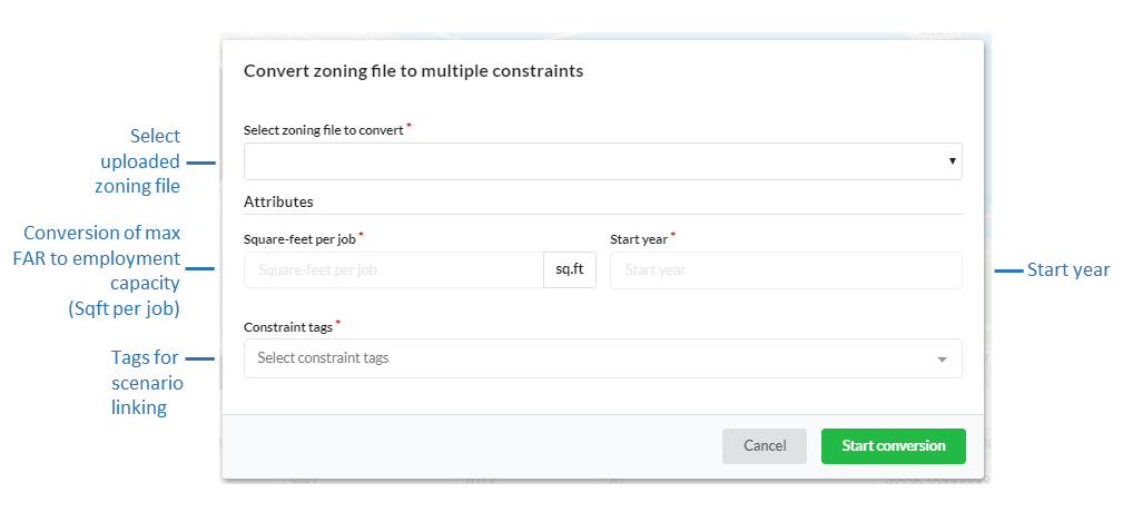
Select the uploaded zoning file to convert, specify the square-feet per job to use in the conversion of the zoning data max FAR to employment capacity, the start year, and a constraint tag to use. If your region has different square-feet per job numbers for sub-jurisdictions, you may upload multiple zoning files for each jurisdiction to apply a different conversion factor to. The name of the uploaded zoning file will be used for the name of each converted constraint, and the residential capacities will be set using the max_dua and employment capacities calculated using the max_far and the specified square-feet per job value following the conversion methodology outlined here. The resulting constraints will also have information populated in their notes that describe the percentage of the intersected zoning designation polygon that overlaps with the corresponding block(s).
The block model assumes that the specified square-foot per job value is an average square-feet per job for all non-residential buildings in your region. If you are unable to determine a square-feet per job value, a good source of rule of thumb data for the US can be found from the U.S. Energy Information Administration (EIA). See the mean square feet per worker field in the latest EIA Commercial Buildings Energy Consumption Survey (CBECS) Data summary tables (Table B1-B2): total and means of floorspace, number of workers, and hours of operation. A default value of 400-500 could be used in place of more accurate information, which closely matches EIA mean square feet per worker for office numbers for the US, however it is suggested that region specific values be used. If your employment capacities do not look reasonable after the conversion adjust your conversion factor accordingly.
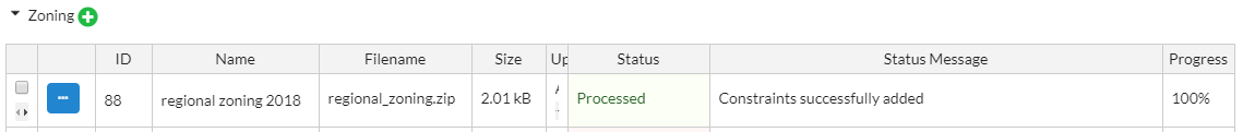
The status of the conversion process can be monitored in uploads under the zoning category under the progress column. Successfully processed files will have a status of Processed. You may convert the same file again any number of times.
Once the process has completed the new constraint records will be automatically populated in the constraints table.
Bulk upload of regional undevelopable data
Note
The constraint tool can be used to denote areas that are undevelopable by assigning selected polygons maximum densities of 0 or regional zoning data can be used to denote large undevelopable areas by setting max_dua and max_far values for specific zoning designations to 0. The bulk uploading of undevelopable data is available by request here as long as the data schema is followed. If using the zoning uploader tool to bulk upload data that only represents undevelopable areas and no other zoning categories, any base data polygons that intersect the undevelopable polygons will be assigned 0 values. To have undevelopable areas proportionally assigned to base data polygons based on area overlap you must also have developable zoning categories in the same file to represent a unified regional zoning dataset.
Editing an existing constraint
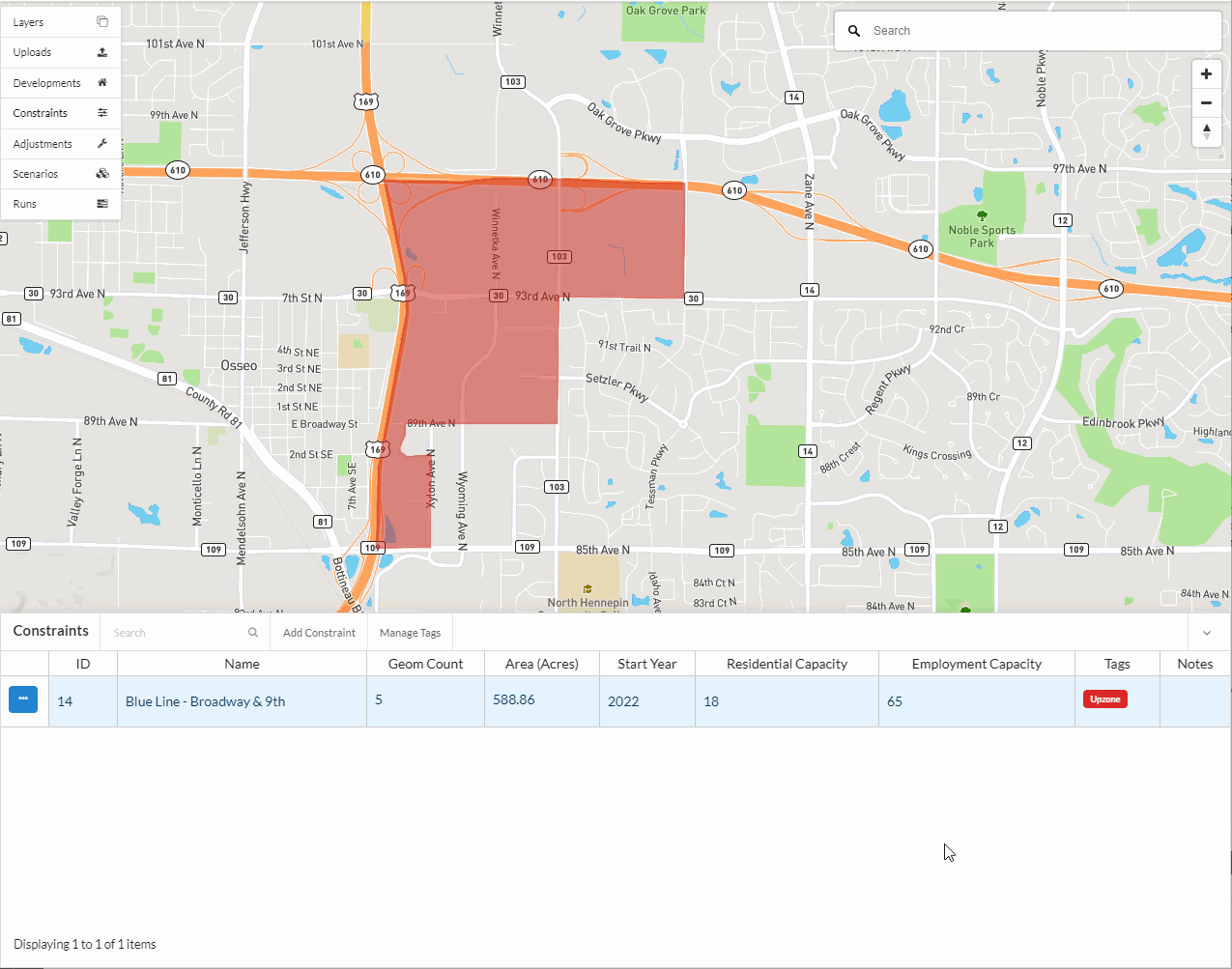
Select the constraint record to edit from the Constraints table and click on the edit icon.
Make the desired changes in the form view.
Click Save edits.
Deleting an existing constraint
Note
At this time you are unable to undo a deletion.
Select the constraint record to edit from the Constraints table and click on the edit icon.
Click Delete in the editor form.
Confirm the deletion.
Notes
If you are seeing over capacity geographies in your simulation results
We suggest you check your base year data and development projects in those specific over capacity geographies.
If simulation results look as if some geographies are over the capacities specified in the constraints that correspond to that geography, this may indicate one of the following is happening: 1) your base data may be over capacity from the beginning of the simulation with more households and jobs than what your constraints will allow. This causes an inconsistency between your zoning constraints and what already exists on the ground in your base year geographies. If your geographies are over capacity in the base year, the model will not assign any new households or jobs to those areas and it wont necessarily remove any to bring it below the capacities specified; 2) The households and jobs added through development projects are allowed to be placed in geographies that are at or over capacity and in some cases can result in generating over capacity geographies.